Geospatial Data Insights Driving Digital Innovation
Introduction to Geospatial Data and Digital Innovation
Geospatial data insights are increasingly driving digital innovation across industries, enabling organizations to harness location-based information for strategic decision-making, operational efficiency, and new product development. By combining spatial intelligence with digital technologies such as artificial intelligence, cloud computing, and big data analytics, businesses and governments can uncover hidden patterns, optimize processes, and create innovative solutions.
The integration of Geospatial data into digital platforms enhances the ability to analyze, visualize, and act upon spatial information. From urban planning and logistics to healthcare and retail, geospatial insights provide the foundation for smarter, more responsive, and technology-driven operations.
Role of Geospatial Data in Digital Transformation
Enhancing Decision-Making
Geospatial data insights empower organizations to make informed, data-driven decisions. By visualizing spatial patterns and trends, decision-makers can identify opportunities, anticipate challenges, and optimize strategies. For instance, retailers can analyze customer distribution and foot traffic to determine ideal store locations or targeted marketing campaigns.
Unlocking New Business Opportunities
Digital innovation fueled by geospatial data allows companies to develop new products, services, and business models. Location-based analytics enable personalized offerings, predictive services, and optimized operations that align with customer behaviors and market dynamics.
Improving Operational Efficiency
Geospatial insights streamline operations across sectors. By integrating real-time spatial data into workflows, organizations can reduce costs, minimize resource wastage, and enhance productivity. Logistics, transportation, and field services benefit significantly from efficient routing, asset tracking, and dynamic planning powered by geospatial intelligence.
Applications of Geospatial Data Insights
Smart Cities and Urban Innovation
Geospatial data is a key driver of smart city initiatives, enabling digital innovation in urban planning, traffic management, and resource allocation. By analyzing population density, transportation patterns, and environmental data, cities can optimize infrastructure, reduce congestion, and improve public services. Real-time geospatial insights allow city authorities to monitor urban dynamics continuously and implement data-driven solutions for sustainable development.
Transportation and Mobility Solutions
Digital transformation in transportation relies heavily on geospatial insights. Ride-sharing platforms, autonomous vehicle systems, and public transit networks leverage spatial data to enhance route optimization, monitor traffic conditions, and improve passenger experiences. Predictive modeling and real-time monitoring support operational efficiency and safety across transportation systems.
Healthcare and Public Health
Geospatial data drives innovation in healthcare by enabling predictive analytics, disease monitoring, and resource optimization. Hospitals and public health organizations use spatial insights to identify high-risk areas, allocate medical resources efficiently, and plan emergency responses. Telehealth services and location-based healthcare solutions also benefit from geospatial intelligence, improving patient access and outcomes.
Environmental and Resource Management
Digital innovation in environmental management relies on geospatial data for monitoring ecosystems, managing natural resources, and mitigating risks. Satellite imagery, sensor networks, and GIS platforms allow organizations to track climate change, pollution, deforestation, and water resources. Predictive modeling and real-time monitoring enable proactive interventions and sustainable resource management strategies.
Business Intelligence and Market Insights
Geospatial insights enhance business intelligence by providing a spatial context to customer behavior, sales performance, and market trends. Companies use geospatial analytics to optimize site selection, supply chain logistics, and marketing campaigns. Advanced visualization techniques, such as heatmaps and interactive dashboards, allow stakeholders to explore spatial relationships and make strategic, data-driven decisions.
Technologies Enabling Geospatial Innovation
Geographic Information Systems (GIS)
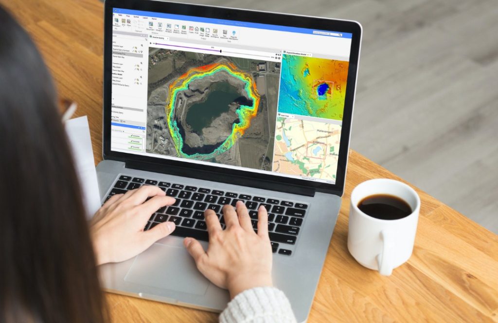
GIS platforms provide the infrastructure for capturing, analyzing, and visualizing geospatial data. Modern GIS tools support integration with AI, machine learning, and cloud computing, enabling predictive analytics, dynamic mapping, and interactive dashboards. GIS facilitates informed decision-making and drives digital transformation initiatives across sectors.
Artificial Intelligence and Machine Learning
AI and machine learning enhance the value of geospatial data by identifying patterns, automating spatial analyses, and generating predictive insights. These technologies allow organizations to detect anomalies, forecast trends, and implement optimized strategies efficiently. AI-powered geospatial solutions are crucial for predictive maintenance, demand forecasting, and urban planning.
Cloud Computing and Big Data Analytics
Cloud computing and big data platforms enable the storage, processing, and analysis of large-scale geospatial datasets. Organizations can integrate multiple data sources, manage real-time data streams, and perform advanced analytics at scale. This technological foundation supports digital innovation by providing accessible, flexible, and scalable geospatial intelligence.
Visualization and Interactive Dashboards
Effective visualization tools translate geospatial insights into actionable intelligence. Interactive dashboards, 3D maps, and immersive visualizations help users explore spatial data, monitor trends, and communicate insights across teams. Visualization facilitates faster decision-making and promotes collaboration in digital innovation initiatives.
Benefits of Leveraging Geospatial Data for Innovation
Enhanced Strategic Planning
Geospatial insights enable organizations to plan strategically by understanding spatial dynamics and market conditions. Companies and governments can forecast demand, anticipate risks, and allocate resources effectively, improving operational and financial performance.
Improved Customer Experience
Digital solutions powered by geospatial data provide personalized, location-aware services. Businesses can tailor offerings, optimize service delivery, and enhance customer engagement by understanding spatial patterns and preferences.
Risk Management and Compliance
Geospatial intelligence supports risk assessment, disaster preparedness, and regulatory compliance. By monitoring environmental conditions, urban hazards, and infrastructure vulnerabilities, organizations can implement proactive measures to mitigate risks and ensure compliance with regulations.
Innovation Acceleration
Integrating geospatial insights into digital platforms accelerates innovation by enabling new products, services, and operational models. Organizations can experiment with data-driven solutions, simulate scenarios, and implement predictive strategies that drive growth and competitiveness.
Challenges in Implementing Geospatial Data Solutions
Data Quality and Accuracy
High-quality geospatial data is essential for reliable insights. Inaccurate or outdated information can lead to flawed analyses and poor decision-making. Organizations must prioritize data validation, integration, and maintenance to ensure accuracy.
Technical Expertise and Infrastructure
Implementing geospatial data solutions requires specialized skills and robust technological infrastructure. Organizations need trained professionals, high-performance computing resources, and cloud-based platforms to manage and analyze spatial datasets effectively.
Privacy and Security Concerns
Geospatial data often involves sensitive information about locations, individuals, and assets. Ensuring data privacy, secure access, and regulatory compliance is critical to maintaining trust and protecting stakeholders.
Future Trends in Geospatial-Driven Digital Innovation
AI-Enhanced Spatial Analytics
The integration of AI with geospatial data will advance predictive modeling, automated analysis, and scenario planning. Organizations will gain deeper insights, enabling proactive decision-making and innovative solutions.
Real-Time Geospatial Intelligence
Real-time geospatial data from sensors, IoT devices, and satellite imagery will enhance operational responsiveness. Organizations can monitor dynamic events, adapt strategies instantly, and make decisions that are both timely and accurate.
Cross-Industry Adoption
Geospatial insights will continue to drive innovation across sectors including healthcare, retail, transportation, agriculture, and environmental management. The widespread adoption of geospatial analytics will support smarter operations, improved services, and sustainable growth worldwide.
Conclusion
Geospatial data insights are a powerful catalyst for digital innovation, transforming industries by providing actionable, location-based intelligence. By integrating GIS, AI, machine learning, cloud computing, and advanced visualization, organizations can optimize operations, enhance customer experiences, and develop innovative solutions.
Applications in smart cities, transportation, healthcare, environmental management, and business intelligence demonstrate the transformative impact of geospatial insights. As technology continues to evolve, leveraging geospatial data will become increasingly essential for driving innovation, operational efficiency, and strategic advantage in a rapidly digitizing world.